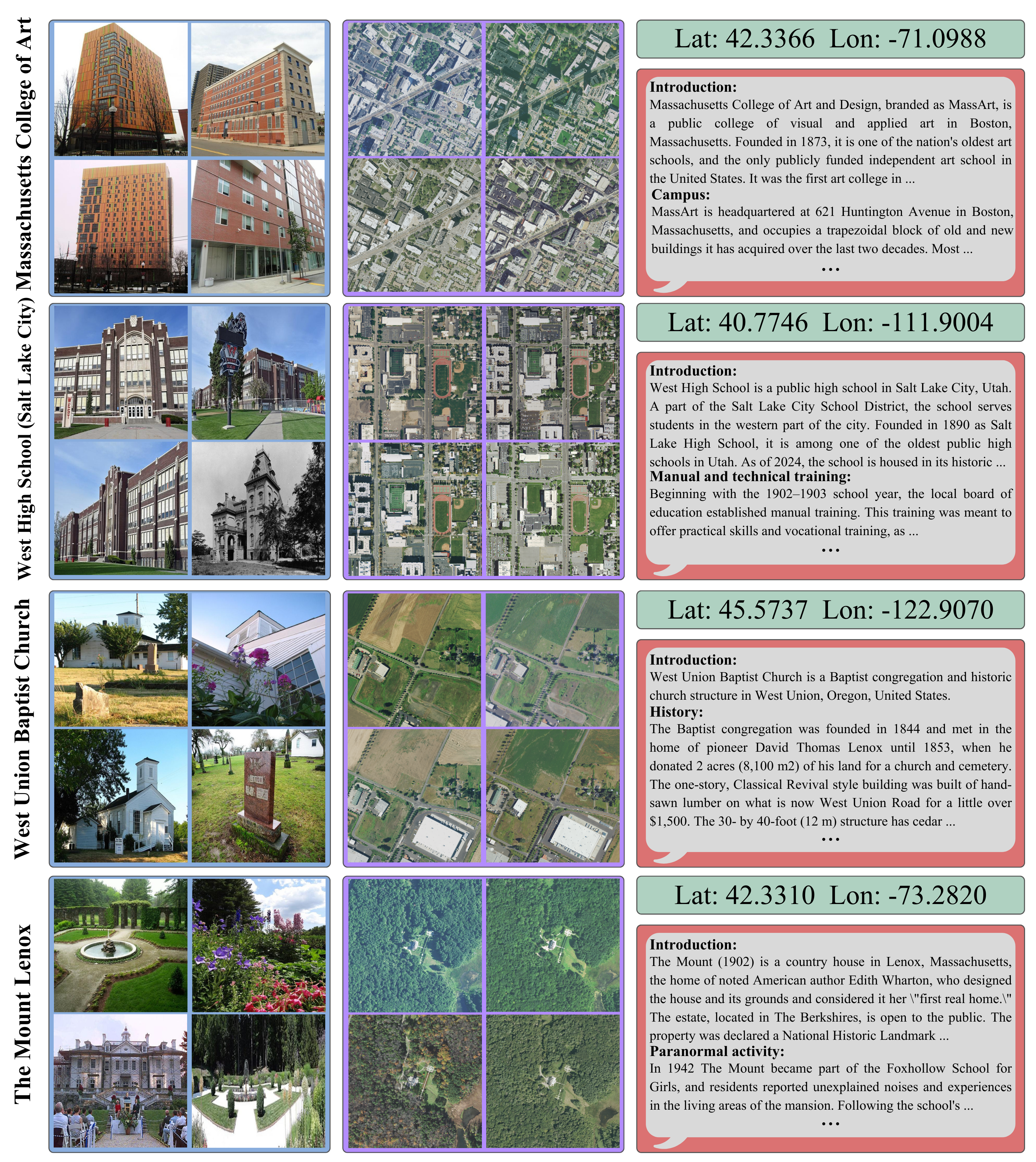
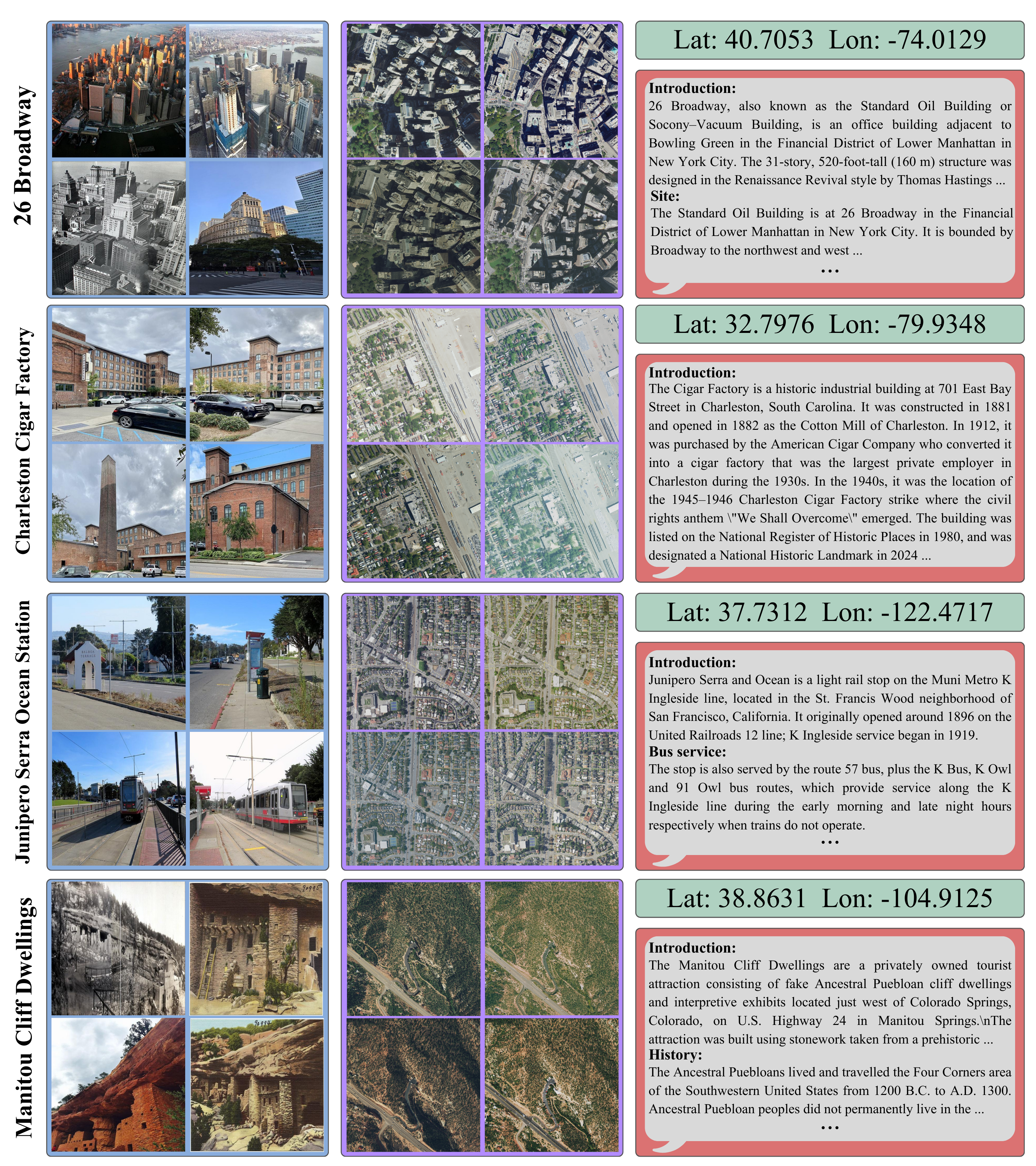
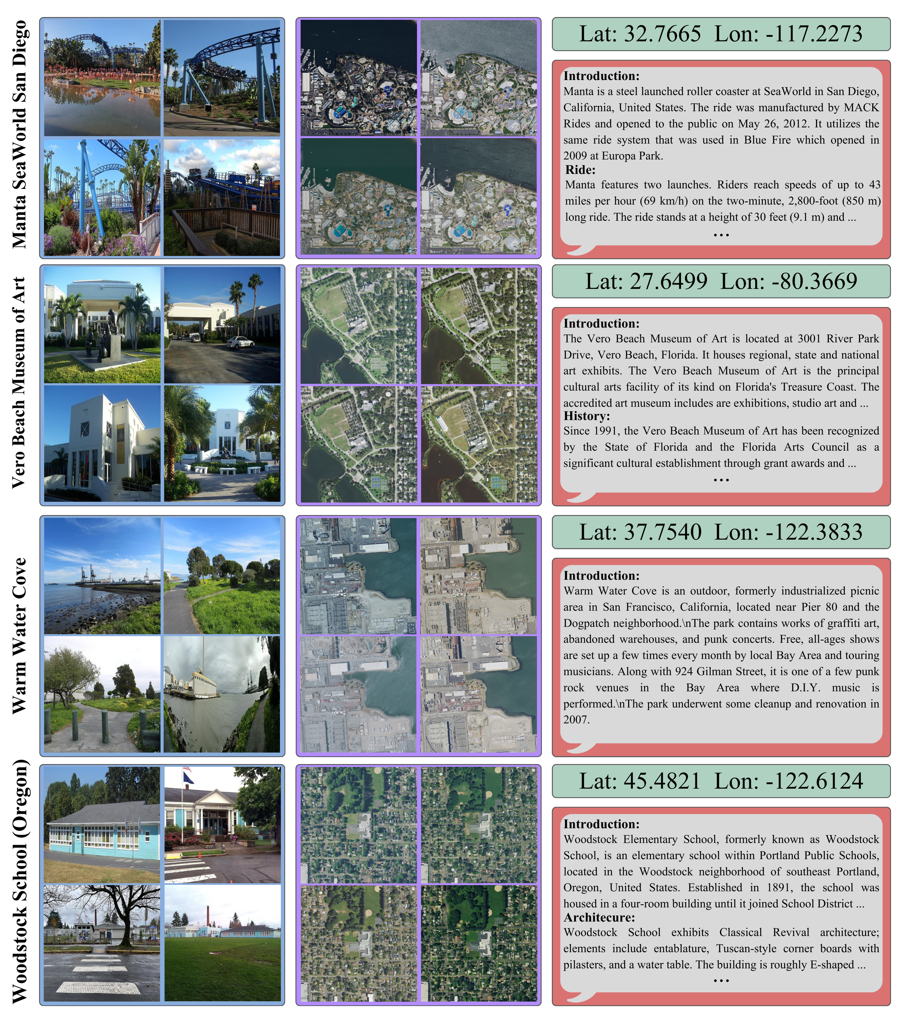
MMLandmarks: We present four distinct data modalities: ground-view images, aerial-view images, GPS coordinates, and textual descriptions, collected from 18,557 unique landmarks in the United States. Data sources are included alongside each modality.
🎉 Accepted at CVPR 2026 🎉
Geo-spatial analysis of our world benefits from a multimodal approach, as every single geographic location can be described in numerous ways (images from various viewpoints, textual descriptions, and geographic coordinates). Current geo-spatial benchmarks have limited coverage across modalities, considerably restricting progress in the field, as current approaches cannot integrate all relevant modalities within a unified framework.
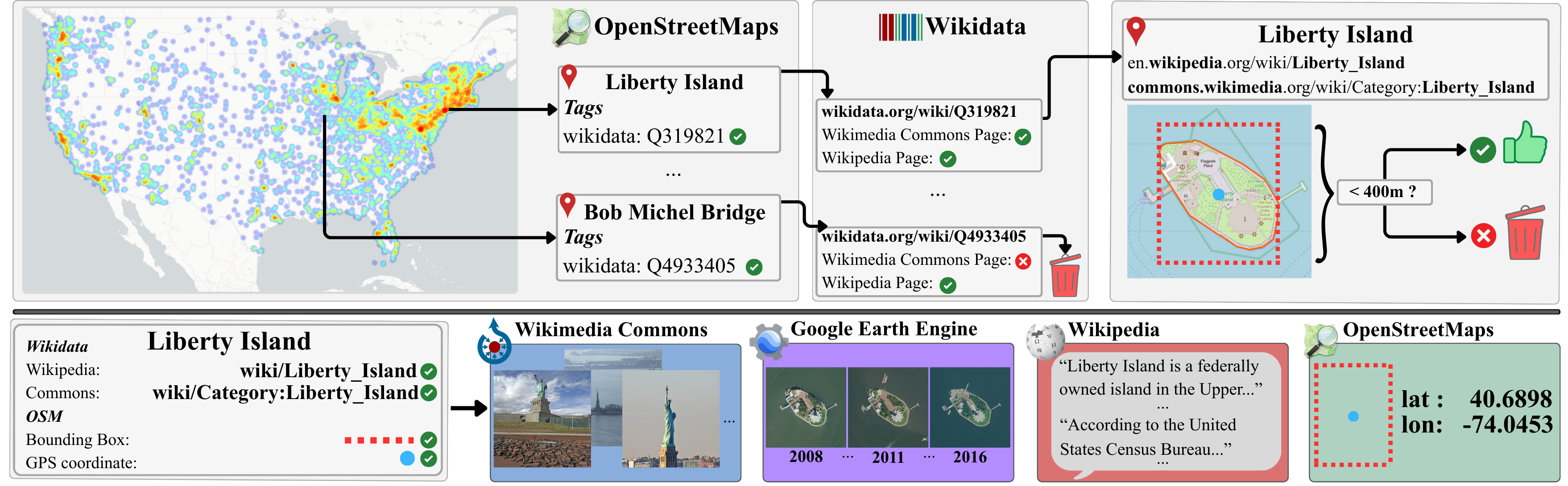
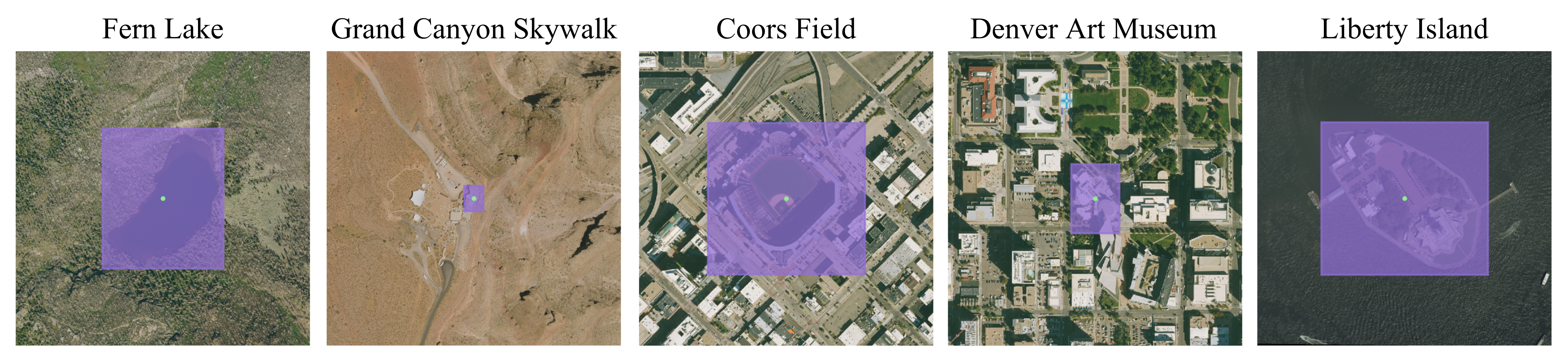
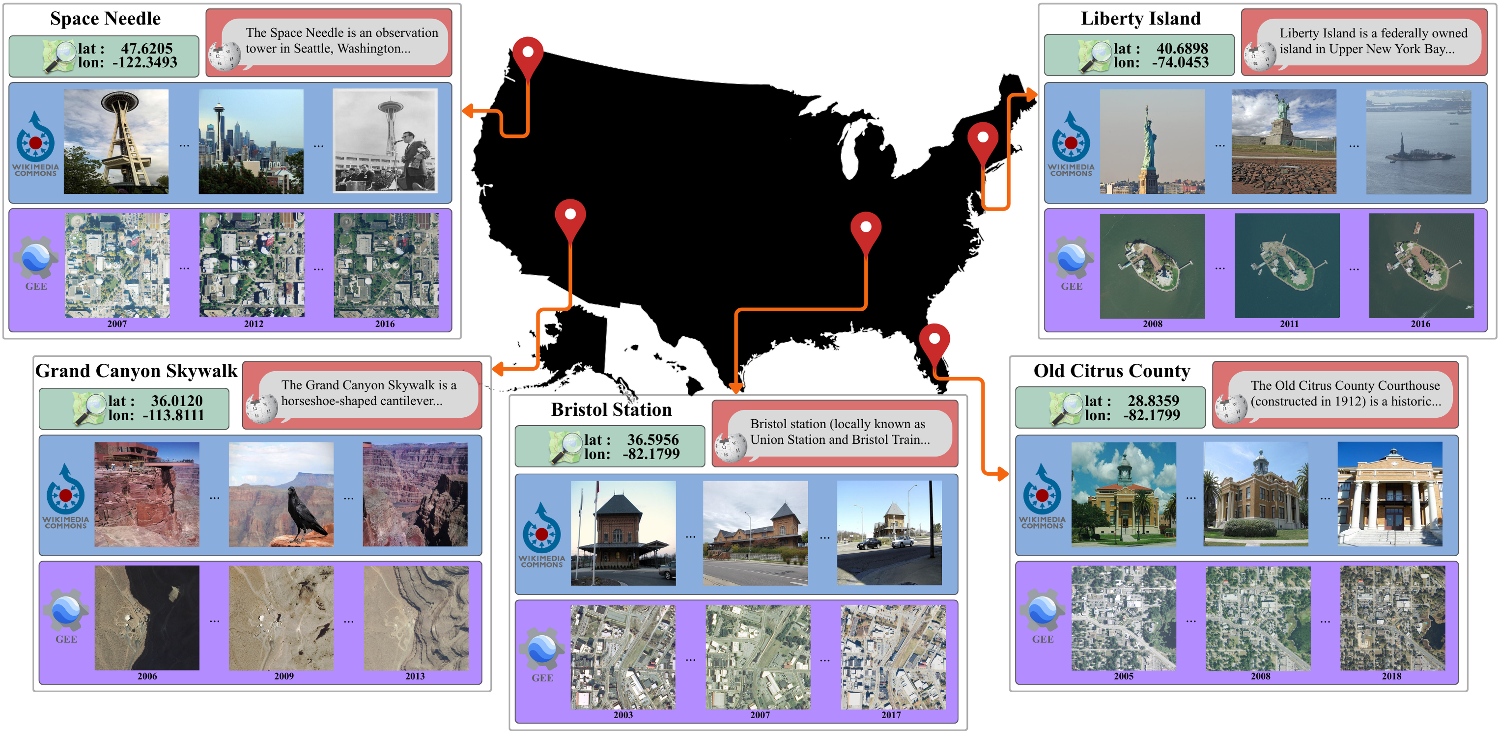
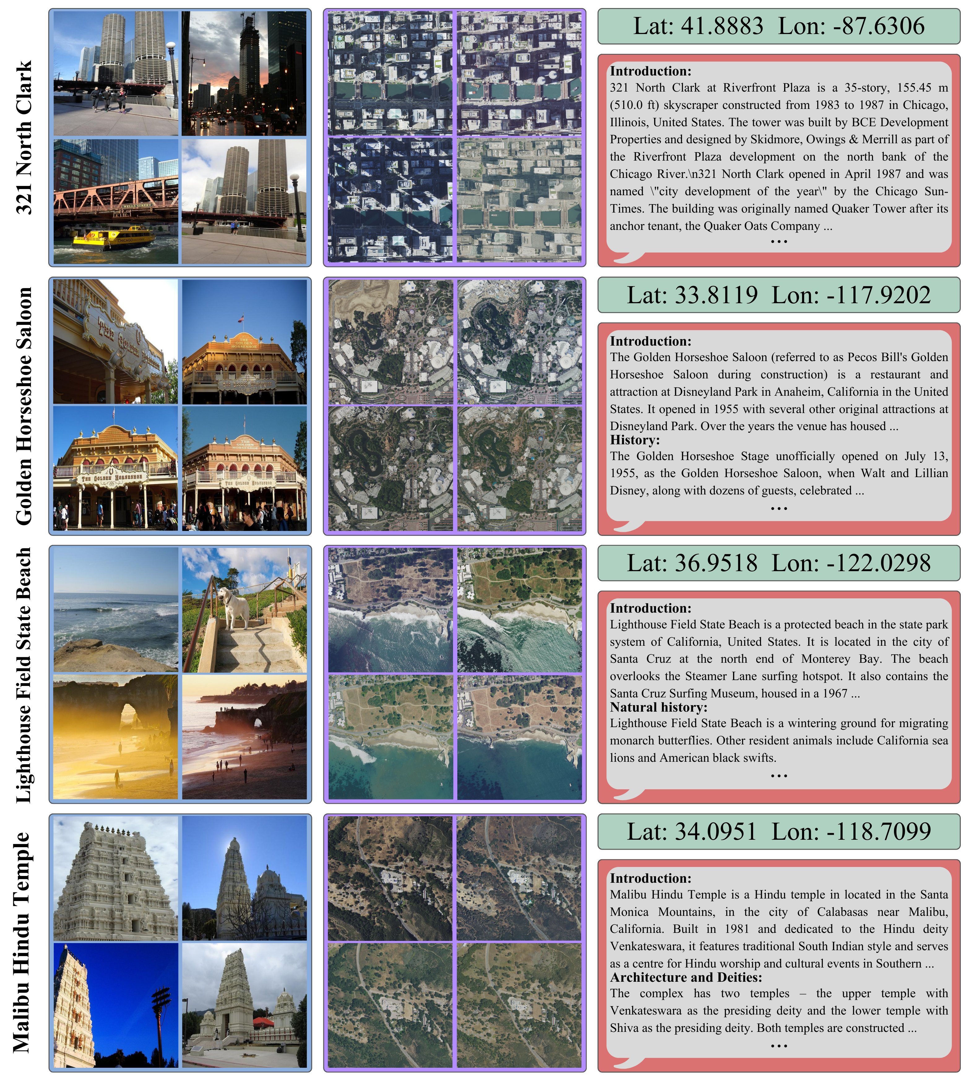
We introduce the Multi-Modal Landmark dataset (MMLandmarks), a benchmark composed of four modalities: 197k high-resolution aerial images, 329k ground-view images, textual information, and geographic coordinates for 18557 distinct landmarks in the United States. The MMLandmarks dataset has a one-to-one correspondence across every modality, which enables training and benchmarking models for various geo-spatial tasks, including cross-view Ground-to-Satellite retrieval, ground and satellite geolocalization, Text-to-Image, and Text-to-GPS retrieval.
We demonstrate broad generalization and competitive performance against off-the-shelf foundational models and specialized state-of-the-art models across different tasks by employing a simple CLIP-inspired baseline, illustrating the necessity for multimodal datasets to achieve broad geo-spatial understanding.
The MMLandmarks dataset is a large-scale multimodal benchmark for geo-spatial understanding, containing four distinct data modalities: ground-view images, aerial-view images, GPS coordinates, and textual descriptions. The dataset encompasses 18,557 unique landmarks across the United States, with a total of 329k ground-view images, 197k aerial-view images, and corresponding textual descriptions and GPS coordinates.
| Task | Dataset | Year | Train(G/S) | Index(G/S) | Instances | Scale (Cities) | Modalities | Open-access | License |
|---|---|---|---|---|---|---|---|---|---|
| Geo localization |
IM2GPS | 2008 | 6.4M/- | - | - | Global | G,C | ✗ | N/A |
| YFCC100M | 2016 | 100M/- | - | - | Global | G,C | ✓ | Flickr TC | |
| PlaNet | 2016 | 126M/- | - | - | Global | G,C | ✗ | N/A | |
| MP16 | 2017 | 4.7M/- | - | - | Global | G,C | ✓ | Flickr TC | |
| OSV-5M | 2017 | 5.1M/- | - | - | Global | G,C | ✓ | CC-BY-SA | |
| Cross-View Retrieval |
CVUSA | 2015 | 35k/35k | 8.8k/8.8k | - | USA(1) | G,S | ✓ | Flickr TC |
| Vo. | 2016 | 450k/450k | 70k/70k | - | USA(11) | G,S | ✓ | N/A | |
| CVACT | 2019 | 44k/44k | 92k/92k | - | Australia(1) | G,S | ✓ | N/A | |
| Uni-1652 | 2020 | 11.6k/701 | 5.5k/1652 | 1652 | 72 Universities | G,S,D | ✓ | N/A | |
| VIGOR | 2021 | 51k/44k | 53k/46k | - | USA(4) | G,S | ✓ | N/A | |
| CV-Cities | 2024 | 162k/162k | 61k/61k | - | Global(16) | G,S | ✓ | N/A | |
| CVGlobal | 2024 | 134k/134k | - | - | Global(7) | G,S | ✓ | N/A | |
| Landmark Retrieval |
R-Oxford | 2018 | - | 5k + 1M/- | 11 | Oxford | G | ✓ | Flickr TC/CC |
| R-Paris | 2018 | - | 6k + 1M/- | 11 | Paris | G | ✓ | Flickr TC/CC | |
| GLDv1 | 2018 | 1.2M/- | 1.1M/- | 30k | Global | G | ✗ | Multiple | |
| GLDv2 | 2020 | 4.1M/- | 764k/- | 200k | Global | G | ✓ | CC/Public-domain | |
| MMLandmarks | 2025 | 329k/197k | 714k/100k | 18,557 | USA | G,S,T,C | ✓ | CC/Public-domain |
@InProceedings{Kristoffersen_2026_MMLandmarks,
  author    = {Oskar Kristoffersen and Alba Reinders and Morten R. Hannemose and Anders B. Dahl and Dim P. Papadopoulos},
  title     = {MMLandmarks: a Cross-View Instance-Level Benchmark for Geo-Spatial Understanding},
  booktitle = {Proceedings of the IEEE/CVF Conference on Computer Vision and Pattern Recognition (CVPR)},
  month     = {June},
  year      = {2026},
}